Effortless Navigation for Complex Transit Hubs with Virtual Tile Routing

Introduction

As cities grow and public transportation systems become more complex, ensuring that passengers can easily navigate through sprawling transit hubs such as airports, train stations, and bus terminals becomes increasingly important. These locations, often designed with multiple levels, terminals, and interconnected routes, can overwhelm passengers, leading to missed connections, delays, and stress. Our patented virtual tile routing technology provides a seamless solution for enhancing the passenger experience by offering clear, personalized navigation assistance, making it easier than ever to move through complex transit hubs with confidence.

Current Frustrations in Transit Hub Navigation

For travelers, navigating a massive transit hub—especially during peak travel times or in unfamiliar locations—can be a daunting task. Complex layouts, multiple transit options, and limited signage often leave passengers feeling lost, which can result in missed departures, inefficiency, and unnecessary stress. Current navigation tools and apps often fail to provide real-time updates or detailed guidance through these intricate environments, leaving gaps in the user experience and creating barriers to efficient travel.

Transit operators and city planners are increasingly looking for innovative ways to optimize passenger flow, reduce congestion, and improve customer satisfaction. A navigation solution that offers clear, step-by-step guidance, with real-time data, is critical for ensuring passengers arrive at their destinations smoothly and on time.

A Cutting-Edge Solution for Seamless Transit Navigation

Our virtual tile routing technology provides an innovative approach to guiding passengers through complex transit hubs. This system creates a virtual map overlay of the hub, divided into tiles, allowing users to easily navigate even the most intricate layouts. Unlike static maps, this system provides real-time route adjustments and personalized directions based on a user’s location, offering a dynamic wayfinding experience that adapts to changes in the environment, such as gate changes, delays, or overcrowded areas.

This technology can be integrated into mobile apps and digital kiosks, providing passengers with an easy-to-use interface for precise navigation. From first-time travelers to frequent commuters, this tool significantly improves the overall transit experience, reducing stress and minimizing travel disruptions. It is particularly effective in hubs that are notorious for their size and complexity, such as international airports or large rail stations.

Key Benefits

  • Real-Time Navigation: Provides continuously updated routes based on the user’s current location, accounting for changes in the environment.
  • Personalized Directions: Offers step-by-step guidance tailored to each user’s transit needs, improving efficiency and reducing stress.
  • Enhanced Passenger Experience: Simplifies navigation in large, complex hubs, leading to increased customer satisfaction.
  • Broad Integration Potential: Can be integrated into existing mobile apps, digital kiosks, and transit management systems.

A New Standard in Passenger Wayfinding for Modern Transit Systems

Licensing this virtual tile routing technology offers transit authorities, city planners, and mobility solution providers a powerful tool for improving passenger movement through large, intricate transit hubs. By simplifying navigation and enhancing the travel experience, this system provides a key advantage in building more efficient, passenger-friendly transportation networks.
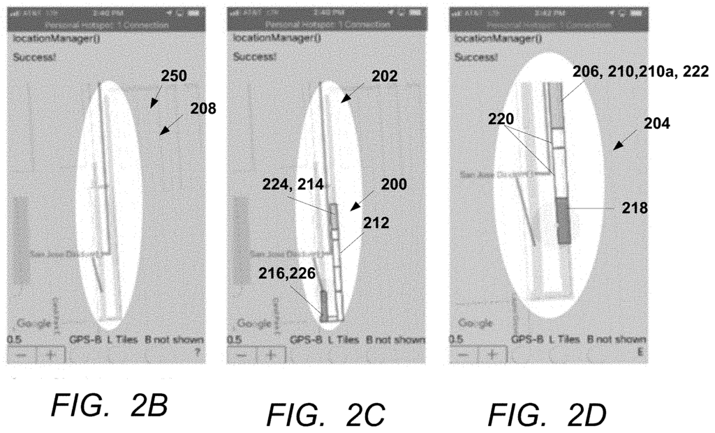
A computer implemented method or system for creating a route for navigating a transit hub or plaza using an application executing on a user’s mobile device. The application accesses a tessellated map comprising first tiles each including a different area of interest on the map; and second tiles including a walkable area connecting the different areas of interest. The application highlights one of the first tiles including one of the different areas of interest selected using input from the user; highlights one of the second tiles including a location of the mobile device on the map; and highlights a series of the second tiles linking the location to the one of the areas of interest. A method of creating the tessellated map is also disclosed.

What is claimed is:

1. A computer implemented system, comprising:

one or more processors; one or more memories; and an application stored in the one or more memories, wherein the application executed by the one or more processors:

accesses a tessellated map, the tessellated map comprising a plurality of tiles on a map of a transit hub or plaza, wherein the tiles comprise:

first tiles, each of the first tiles including a different area of interest on the map; and
second tiles, wherein a combination of the second tiles includes a walkable area connecting the areas of interest; and

causes a display or a speaker of a mobile device coupled to the one or more processors to:

indicate one of the first tiles including one of the different areas of interest selected using input from the user;
indicate the one of the second tiles including a location of the mobile device on the map; and
indicate a series of the second tiles linking the location to the one of the areas of interest.
2. The system of claim 1, wherein the application requests input of the areas of interest comprising at least one area selected from a boarding area, a ticketing area, a ticket checking area, a crossing area, a shelter area, and an exit area.

3. The system of claim 1, wherein:

the application requests a destination served using a departure from a boarding area in the transit hub; and
the one of the different areas of interest comprises the boarding area.
4. The system of claim 3, wherein the application receives or determines the boarding area using data on a server computer coupled to the mobile device, the data comprising information on the boarding area associated with a transport route serving the destination from the transit hub.
5. The system of claim 4, wherein the transport route is a bus route, a railway route, a taxi route, or a flight route.
6. The system of claim 1, wherein the application indicates the one of second tiles including the location of the user as the user moves in relation to the one of the different areas of interest.
7. The system of claim 1, wherein the application indicates the tiles on the display using a color.
8. The system of claim 1, wherein the application indicates the tiles on the display using highlighting or a representation readable by the user comprising a visually impaired user.

9. The system of claim 1, wherein the application causes the speaker of the mobile device to output:

a verbal signal identifying the second tile including the user’s current location with respect to a relevant landmark, and
a verbal instruction providing a direction to the next tile in the series of the tiles leading to the area of interest.
10. The system of claim 1, wherein the application sizes the tiles on the display to represent an area in the transit hub or plaza in a range of 1 foot by 1 foot to 10 feet by 10 feet.
11. The system of claim 1, wherein the tiles are sized so that an entirety of the route is highlighted using the tiles on a display of the mobile device.

12. The system of claim 1, wherein:

the tiles comprise shapes or polygons, and
the tessellated map comprises the tiles fitted together in a pattern on the map without gaps or overlapping between the tiles.
13. The system of claim 1, wherein the application receives the location determined using a global positioning system (GPS) or a beacon signal received in the mobile device.
14. The system of claim 12, further comprising the mobile device receiving the beacon signal transmitted from one of a plurality of transmitters in the transit hub or the plaza.
15. The system of claim 1, wherein the application receives the tessellated map from a server computer in response to a request from the application executed on the mobile device.

16. The system of claim 1, wherein:

the plaza comprises a shopping mall, a hospital, office buildings, or a factory, or
the transit hub comprises an airport, metro station, railway station, or bus station.

17. A computer implemented method, comprising:

creating a route for navigating a transit hub or plaza using an application executing on a user’s mobile device, including:

accessing a tessellated map, the tessellated map comprising tiles on a map of a transit hub or a plaza, wherein the tiles comprise:

first tiles, each of the first tiles including a different area of interest on the map; and
second tiles, wherein a plurality of the second tiles include a walkable area connecting the different areas of interest;
indicating one of the first tiles including one of the different areas of interest selected using input from the user;
indicating one of the second tiles including a location of the mobile device on the map; and
indicating a series of the second tiles linking the location to the one of the different areas of interest.
18. The method of claim 17, wherein the indicating comprises indicating the one of second tiles including the location of the user as the user moves in relation to the one of the different areas of interest.
19. The method of claim 17, wherein the indicating comprises highlighting using a color.
20. The method of claim 17, wherein the indicating comprises highlighting using a representation readable by the user comprising a visually impaired user.

Share

Title

Virtual tile routing for navigating complex transit hubs

Inventor(s)

Jonathan Lam, Fatemeh Mirzaei, Roberto Manduchi

Assignee(s)

University of California

Patent #

20210018321

Patent Date

January 21, 2021

Inquire about this intellectual property

Learn more about "Effortless Navigation for Complex Transit Hubs with Virtual Tile Routing"